-

图 1 CO2矿化封存备选场址雷州半岛田洋的地形、钻井位置以及地质背景图(点:钻井;虚线:火山断陷盆地边界)
Figure 1. Topography, drilling location, and geological background map of alternative sites for CO2 mineral sequestration in basalt of Tianyang, Leizhou Peninsula, China. (dot: drilling; dashed line: boundary of volcano-graben basins)
-
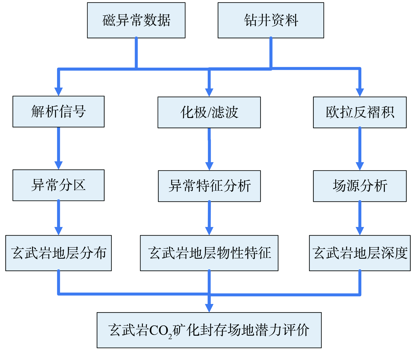
图 2 磁法数据与钻井资料处理和解释用于玄武岩CO2矿化封存场地潜力评价技术路线图
Figure 2. Flow chart for evaluating the potential of CO2 mineral sequestration in basal using magnetic and drilling data processing and interpretation
-

图 3 田洋地区磁总场异常等值线图
Figure 3. Contour map of the total field magnetic anomalies in the Tianyang area
-
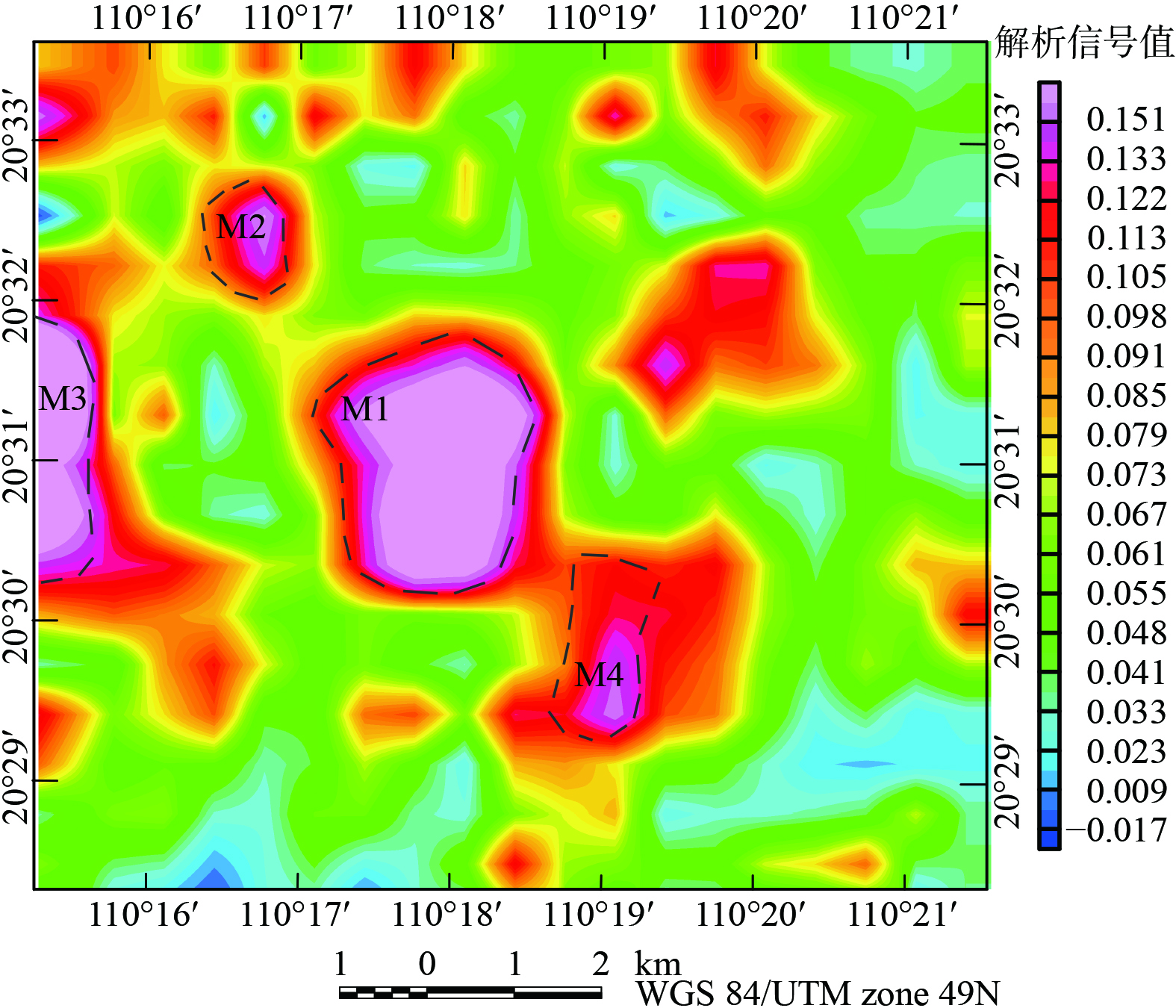
图 4 田洋地区磁总场异常的解析信号与异常分区
Figure 4. Analytical signals and anomaly zoning of the total magnetic field anomalies in the Tianyang area
-

图 5 田洋地区磁总场异常化极等值线图、异常分区和解释测线位置
Figure 5. Contour map of the anomalized poles of the magnetic total field in the Tianyang area, anomalous partitions, and locations of interpreted survey lines
-
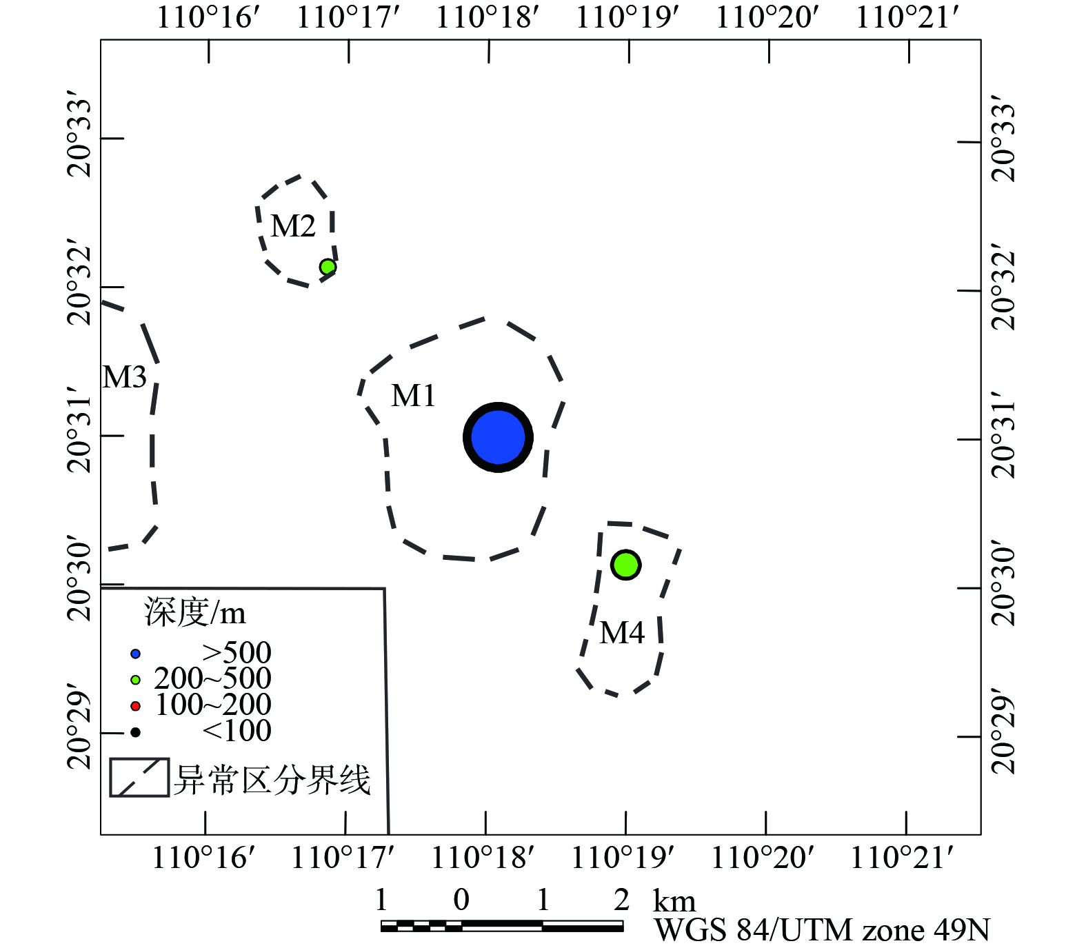
图 6 田洋地区航磁异常定量解释图
Figure 6. Quantitative interpretation of aeromagnetic anomalies
-

图 7 田洋火山断陷盆地的北西-南东向解释剖面图
Figure 7. Interpretation profile of the north-west-south-east oriented geologic profile of Tianyang volcano-graben basins
-

图 8 田洋火山断陷盆地的南西-北东向解释剖面图
Figure 8. Interpretation profile of the south-west-north-east oriented geologic profile of Tianyang volcano-graben basins
Figure
8 ,Table
3 个